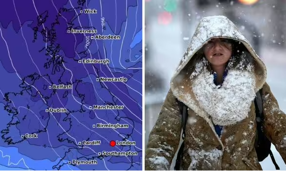
The UK could get its first snowfall by the end of this month – temperatures are expected to drop and snow is on the way to these regions.

The UK could see its first snowfall of the winter in a matter of days as temperatures plunge (Image: WXCHARTS / GETTY)
New UK weather maps show much of the country being smothered in snow ahead of a brutal freeze that could send temperatures tumbling to as low as -9C.
Maps from WXCHARTS show between 14cm and 19cm of snow could fall around Newcastle and the whole of the North East as a whole on November 20, with snow depths of 16cm in northwest Scotland near Inverness.
England could even get a sprinkle of snow, with 2cm forecast for cities such as Manchester in the North West.
The maps show the heavy snowfall continuing on November 21, with up to 27cm falling in northern Scotland, with the rest of the UK turning purple – suggesting millions of Britons could be hit. Londoners could even see some snowfall.
This snow trend continues into November 22, with an area in the far north of Scotland set to be hit by more than 30cm, with a small area of North West England and northern Wales also set to receive a sprinkle.

WXCHARTS maps show snowfall with mostly impact the Scotland and northern England (Image: WXCHARTS)

Maps show freezing air engulfing the UK later this month (Image: WXCHARTS)
In addition, the UK temperature maps turn icy blue around this period, suggesting millions of Britons could be hit by a bone-chilling deep freeze.
The latest weather maps show the coldest weather will be felt around midnight on November 23 which could see the mercury tumble to as low as -10C in an area between Manchester and Newcastle, with lows of -9C showing in northern Scotland.
Elsewhere in England, tens of millions of Britons could be left freezing in temperatures ranging from 0C to -8C.
The Met Office’s long-range forecast from November 17-26 says: “Turning more unsettled and significantly colder as we head into the weekend with rain or showers for most regions, the heaviest and most frequent spells of rain are most likely in the north where they are likely to turn wintry, especially to the hills of Scotland, but perhaps also to lower levels in the far north as colder air digs south.

Brits could be left freezing in temperatures ranging from 0C to -8C (Image: WXCHARTS)
“The chance of any widespread or disruptive snowfall affecting more populated areas at this stage however remains low.
“Less certainty for the south but even here there is a chance of some more organised rain, and potentially some hill snow.
“Often windy, with a chance of gales at times, especially in the north and east. Temperatures falling below average and feeling particularly cold in the strong winds.”
Met Office five-day forecast
Today:
Fog and frost clearing through Wednesday morning, although perhaps slower to clear in the northwest and Northern Ireland. Elsewhere, dry and mostly sunny spells, but light rain and drizzle continuing to move southwards across western Scotland.
Tonight:
Good deal of low cloud across western and central areas, with drizzle on some upslopes. Clear spells and patchy fog in far north and south with local frost.
Thursday:
A mostly cloudy day for all with clearer conditions for eastern Scotland a sunny spells in the southeast. Light rain and drizzle in western Scotland, otherwise remaining dry.
Outlook for Friday to Sunday:
Gradually turning cloudier through the end of the week with outbreaks of rain at times, mainly in the north. Chilly overnight with fog and frost in places.

