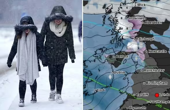
The latest weather maps show snow over parts of Britain for in excess of 48 hours later this month.

Snow maps show a huge 48 hour barrage is set to hit the UK with a -12C Arctic blast (Image: Getty/WX Charts)
The UK looks set to be plunged into freezing conditions for some 48 hours with temperatures plummeting as low as -12C in some places, the latest weather maps show.
Britons hoping for a white Christmas may see their wish granted with maps showing snow in Scotland, the North of England and parts of Wales on December 25, according to maps generated by WX Charts.
That picture looks set to continue for at least the following two days, with snow on Boxing Day, December 27 and possibly into the weekend if WX Charts’ maps prove to be accurate this far out.
Snow depths of 12cm on high ground in central Scotland and 14cm in the Pennines also appear on maps for December 26-27.
Meanwhile, one map has turned icy blue showing minimum temperatures of -12C around Fort William at midday on December 27. Elsewhere, Dundee could see -1C, Newcastle 0C and Carlisle 0C to -1C, according to WX Charts.

This map shows snow across northern Britain at 6am on Boxing Day (Image: WX Charts)

This map shows a minimum temperature of -12C in Fort William on December 27 (Image: WX Charts)
A map generated on Friday (December 13) by Netweather shows the highest risk of snow at 6am on Christmas Day affecting the southern half of Wales and the south of Scotland. There is also around a 50% risk in the Home Counties, the map shows.
While the maps suggest it will be a white Christmas, the Met Office said on Wednesday that it is too early to call.
The forecaster said single models aren’t reliable enough to come up with a detailed forecast and are only part of a wide range of information required to give a full picture.
Forecasting “impactful snow” is said by the Met Office to be especially tricky in the UK, with a number of factors expert meteorologists look for and numerous competing elements which all have to be exact for snow to fall.
The Met Office said: “Sometimes, just a fraction of a degree in temperature can make the difference between the chance to build a beautifully formed snowman, and the joys of a sleety slushy day.”

Here you can see the UK looks set to freeze at midnight on December 27 (Image: WX Charts)

This map shows the risk of snow is highest in parts of Scotland and Wales on Christmas Day (Image: Netweather)
Met Office UK five-day weather forecast
Friday, December 13 – Tuesday, December 17
Turning brighter tomorrow. Cloudy and windy on Sunday.
This evening and tonight will remain cloudy across much of England and Wales, with more rain and drizzle in places. The rain moves south across Scotland and Northern Ireland, bringing clearer skies and scattered blustery showers. It will turn colder under clear skies in the north.
Saturday will be a brighter day for many Brits as cloud and rain clears to the south, with sunny spells and scattered showers following. Cloud and rain is expected to return to the northwest later. It will be rather breezy.
Outbreaks of rain will affect northern and western parts from Sunday and through to Tuesday. It will be generally dry elsewhere, but cloudy. The best of any brighter breaks will be in the east. It will be windy, but mild.

