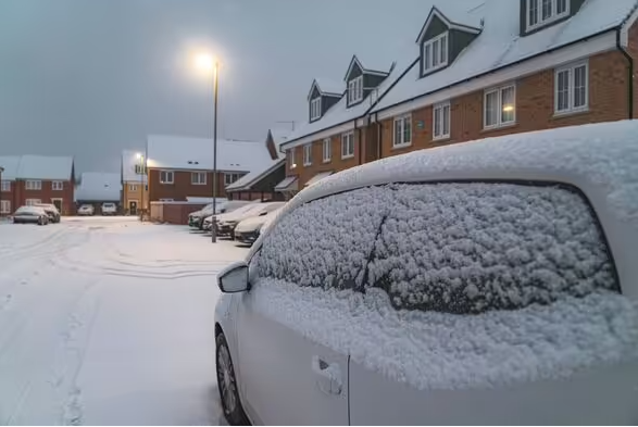
The latest snow maps show a 520-mile blanket of snow covering a chunk of the UK, stretching as far south as London.

Snow could hit several parts of the UK in the coming weeks (Image: Getty)
The latest weather maps show snow covering a significant chunk of the UK at the beginning of February. January has seen its fair share of wintry weather, most recently with extreme winds and flooding as a result of Storm Chandra. While spring is on the horizon, cold and wintry conditions look like they will continue for the next week or two. Forecaster WXCharts shows snow covering much of the UK on Thursday, February 5, stretching from the northern tip of Scotland all the way down to London.
Separately, the Met Office has previously warned of the risk of snow in February. However, snow can be difficult to predict, as slight temperature changes or varying air moisture levels can determine whether snow falls or not. But according to the latest projections, there will be some snow in the first half of February. Scotland is by far the worst hit region, but many parts of England might expect snow in the coming weeks.

Snow will hit the UK in several places in February (Image: WXCharts)
The counties that will experience snow on Thursday, February 5, according to WXCharts, are:
Scotland:
- Aberdeenshire
- Angus
- Argyll
- Banffshire
- Berwickshire
- Buteshire
- Caithness
- Clackmannanshire
- Dunbartonshire
- East Lothian
- Fife
- Inverness-shire
- Kincardineshire
- Kinross-shire
- Lanarkshire
- Midlothian
- Moray
- Nairnshire
- Orkney
- Peebleshire
- Perthshire
- Renfrewshire
- Ross and Cromarty
- Selkirkshire
- Shetland
- Stirlingshire
- Sutherland
- West Lothian
England
- Northumberland
- Cumbria
- Tyne and Wear
- Durham
- North Yorkshire
- East Riding of Yorkshire
- Lancashire
- West Yorkshire
- Greater Manchester
- Merseyside
- Cheshire
- Staffordshire
- Derbyshire
- South Yorkshire
- Derbyshire
- Nottinghamshire
- Leicestershire
- Rutland
- West Midland
- Warwickshire
- Northamptonshire
- Bedfordshire
- Buckinghamshire
- Hertforshire
- Greater London

Temperatures will be low across the country with wintry conditions continuing (Image: WXCharts)
The Met Office has predicted a wet and blustery weekend ahead (Saturday, January 31 and Sunday, February 1). It currently reports that there is a risk of snow throughout February in several parts of the country.
From February 2, the Met Office expects “unsettled” weather, similar to conditions we have seen towards the end of January. The forecast reads: “Some hill snow is likely in the north too. Temperatures will be close to average for most, but perhaps rather cold in the far northeast.
“A subtle change is now looking likely during the second half of this period, as the winds look like backing off to more of an easterly or northeasterly direction. It is likely to remain largely unsettled, especially towards the south, but it is likely to become colder with an increasing risk of snow, more particularly in the north. An often brisk wind will accentuate the colder feel too.”

Conditions will be relatively windy as well (Image: WXCharts)
Current WXCharts maps show snow continuing to fall in Scotland and the North East of England throughout the first half of February. Meanwhile, temperatures are expected to be chilly.
The Met Office’s current prediction for the second half of February (from February 12) reads: “Something of a north-south split seems quite likely at first, with low pressure to the south and high pressure to the north, before a potential change back to more of a southwest-northeast split, similar to the current setup.
“With the jet stream likely further south than normal, the wettest conditions are more likely towards the south. Northwestern parts of the UK are most likely to be drier than normal. Whilst incursions of wet, windy and milder weather are favoured at times in the south and later the west, colder conditions further north will bring an increased risk of wintry hazards, especially where any precipitation from the southwest interacts with the cold air. “